
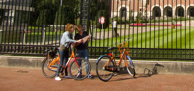
A visit to The Hague isn't complete without a bike tour through the city. Many touristic highlights and the seaside resort of Scheveningen are within easy cycling distance from the city centre. Here are some tips for finding your way around The Hague.
 Finding your way around The Hague. Photo © Holland-Cycling.com
A popular way of getting around The Hague - for both residents and tourists - is by bike. It's convenient, as you can cover more distance than on foot, it's fast and you can stop to look around and take photos wherever you want. The Hague has good cycling infrastructure. Most of The Hague's main streets have separate cycle lanes and a network of cycle paths takes you through the city fast - and away from other traffic whenever possible.
Many touristic highlights in the region of The Hague, such as the seaside resort of Scheveningen and Delft, are also within easy cycling distance. There are good through cycle routes that will take you from the centre of The Hague to the surrounding countryside and villages or to the dunes and along the coast. It's a great way to experience the Dutch cycling culture!
Cycle maps of The Hague
To find your way around The Hague, you can use a regular tourist map, but there are also special cycle maps of The Hague and the region. These maps are made in co-operation with the Dutch Cyclists' Union. They not only give the touristic sigts, but also help you find the most bike-friendly routes through the city and to the surrounding countryside. The maps can be purchased at local VVV tourist information offices and bookshops.
For a review of this series of cycle maps see: Amsterdam by bike maps reviewed.
Den Haag op de fiets
Cycle map of the city of The Hague by Cito-plan
- scale 1:12,500
- all cycle paths
- bike friendly cycle routes through the city (marked in green)
- bicycle services (bike rental, bike parking, bike repair)
- touristic highlights
- public transport
- street names
Zuid-Holland Midden op de fiets
Cycle map of the region of The Hague by Cito-plan
- scale 1:50,000
- all cycle paths, numbered cycle network
- bicycle services (bike rental, bike parking, bike repair)
- touristic highlights
- street names
Of course there are cycle maps of the whole of Holland that also cover the region of The Hague. For an overview, go to Planning your route - maps & books.
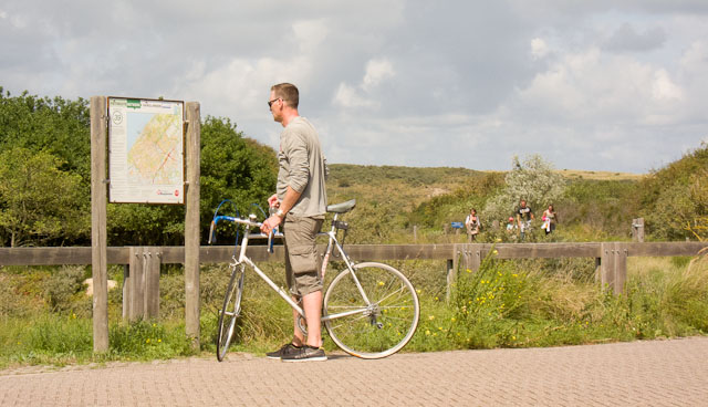
Signposting for cyclists
Dutch cycle paths are so well signposted, that even if you might not always know precisely where you are, you can hardly get lost. While the regular signposts for motorists are all blue, the signposts for cyclists are red and white or green and white.
 Information board for the numbered cycle network. Photo © Holland-Cycling.com
The red and white signposts are for cyclists and moped riders. The green and white signposts are only for cyclists. These will usually take you along more scenic routes where mopeds are not allowed.
Smaller green and white signposts are used for signposting the national long-distance cycle routes (LF routes) and the numbered cycle network that takes you along scenic routes through the whole of Holland.
Also see:
