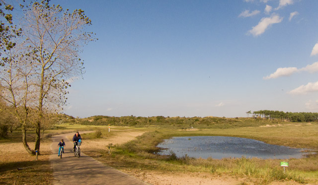
Coast, polders and nature reserves
Distance: 40 or 29 km

Please note:
In case of extreme rainfal, several cycle paths in the dunes of National Park Zuid-Kennermerland can be flooded and therefore not accessible. Please check out National Park Zuid-Kennemerland's website for the current situation before you set off.
This route shows you two different sides of Haarlem: to the east typical Dutch polders and to the west sand dunes and beaches. Highlights of the route are the dunes of National Park Zuid-Kennermerland and the historic centre of Haarlem.
From the bridge over the Spaarne you get a view of the skyline of Haarlem. Leaving the city, you cycle through flat open polders to the villages of Penningsveer, Spaarnwoude and Spaarndam. You pass several fortifications of the Defence Line of Amsterdam which is now a UNESCO World Heritage site. From Santpoort the route takes you through the dunes of National Park Zuid-Kennemerland to the seaside resort of Zandvoort. Via the old tram track you return to the centre of Haarlem.
Haarlem Dunes Cycle Route |
|
| Distance: | 40 km (2h40), or 29 km (2h) |
| Type of route: | Day trip, round trip |
| Starting point: |
Haarlem train station |
| GPS: | Download this route as a GPX file. |
Find out more:- For an overview of all of our must-do cycle routes, go to: Day trips.- Do you need to rent a bike? Find out how on our Bicycle rental page. - For an overview of guided tours from Haarlem, go to our Guided tours section. - For an overview of cycling holidays that include Haarlem, go to our Holidays section. |
|
Click on one of the images to start a slideshow


