There are around 50 numbered regional cycle networks in Holland, which are all connected. Together they form a large national cycle network that will take you all around the country. The idea behind the numbered cycle network is that you can use it to plan your own day trip. There is no reason why you shouldn’t use it set out your own long-distance cycle route.
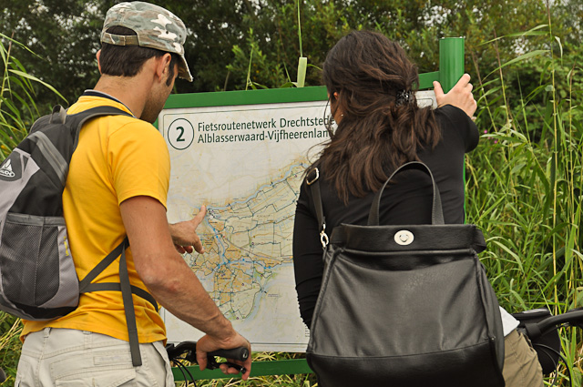
 The numbered cycle network is an easy way of planning your daytrip. Photo © Holland-Cycling.com
The numbered cycle network takes you along bicycle friendly, scenic routes that avoid heavy traffic. As it is intended for recreational cycling, it won't necessarily go for the shortest option. If you are looking for the shortest and quickest route, you can better use the online cycle route planner or a detailed cycle map.
How does the numbered cycle network work?
Each regional cycle network is a grid of scenic routes, connected by numbers. The Dutch call the numbers knooppunten, which is usually translated as ‘junction points’. You can make your own route by simply cycling from one number to the next. The stages between the numbers are signposted in both directions. At most numbers, or junctions, you'll find an information board showing you where you are.
This system saves you the hassle of regularly having to stop to consult your map. All you have to do is decide where and how far you want to cycle. Just write down the numbers and off you go!
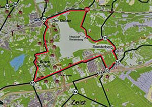
Example  Photos © Holland-Cycling.com You can use an information board of the numbered cycle network to plan your route. In this example, you are at junction number 56 (photo on the left). Let's presume that the route marked in red (see detail photo on the right) is the route you've set out. This means your route passes the junctions numbered 56 - 55 - 52 - 53 - 85 - 95 - 56. Now all you have to do, is remember these numbers and follow the green and white signposts accordingly from one junction to the next. Your route will be marked either way round. |
Planning your own route

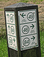
Signposts take your from one number to the next. Photo © Holland-Cycling.com
- Set out your route on a cycling map with the numbered cycle network, on an information board along the route, or on the cycle route planner. The distance between two numbers is always given on the map, so you can work out the length of your route.
- Decide which way round you want to cycle, write down the numbers of your route and you’re ready to go.
- Do you want to change your route as you go along? In most regions there are information boards with a map of the region at each number, or junction (see example above).

