
The LF Waterline Route takes you along the major Dutch Waterlines, military lines of defence that relied on forts, bunkers, fortress towns and inundated land to defend the country.
 Fort Vechten near Utrecht. Photo © Holland-Cycling.com
From the Zuiderzee town of Edam to the garrison town of Bergen op Zoom on the Schelde - the LF Waterline Route takes you on a journey into the military history of the so-called Waterlines, a typical Dutch defence system that makes use of one Holland’s strengths: water management.
In times of danger, large areas of land could be inundated in a matter of days thanks to a complex system of sluices, dams, dykes and flood canals. The water would only have been around 40 cm deep, but that was enough to make it impossible for the enemy to cross by foot or by boat and advance to Holland’s major cities. The weak points in this natural defence line were the higher grounds which could not be flooded. These sections of the waterline were strengthened with bunkers, group shelters and forts.
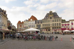
Besides military history, you can also enjoy a variety of typical Dutch landscapes and historical towns, such as Edam, Weesp, Culemborg and Bergen op Zoom, along the way.
Tip
Combine this long-distance route with a day trip. We recommend:
Click on one of the images to start a slideshow


LF Waterline Route (LF Waterlinieroute) |
|
| Route: | Edam - Bergen op Zoom |
| Distance: | 410 km |
| Connections: |
Edam - LF Zuiderzee Route |
| Maps: | Online cycle route planner, or any good cycle map |
| GPS tracks: | Download from Nederland Fietsland |
